
Walk Brookhaven Streets by Address
A sound Brookhaven street directory search separates ownership from occupancy. The DeKalb appraisal roll identifies the legal owner tied to a parcel. Its site address locates the land, while its postal address routes tax mail. Those fields may match, but a match only supports an owner-occupancy inference. It does not name every person in the home. Deeds add a recorded chain of title. Permits add dates and project parties. Historical directories can supply occupants whom property rolls miss.
Start with one exact address, then widen the view one lot at a time. Keep the parcel ID with every note because street spelling and numbering can change. The sequence below prevents a name from being attached to the wrong lot.
- Enter the address in the DeKalb property search. Copy the parcel ID, legal owner, site address, postal address, subdivision or condominium name, and latest deed reference.
- Open DeKalb GIS and select the same parcel. Zoom along the block, click each adjoining polygon, and record its parcel ID before moving farther down the street.
- Use the book and page supplied by GIS in LandmarkWeb. If no reference is shown, search by owner, parcel, legal description, instrument, or date.
- For a lawful elector-list project, request an existing geographic extract from election officials. My Voter Page is an identity-gated personal lookup and cannot browse a street.
- For past occupants, ask Decatur Library for Atlanta directories and any reverse or criss-cross volumes covering the road name and period.
The chain is concise: address to parcel, parcel to owner, owner to deed, then directory or lawful voter evidence to possible occupants. Verify every claimed resident in a second source.
Build a simple research log as the Brookhaven street search moves outward. For each lot, write down the exact site address, parcel ID, owner spelling, postal destination, source date, and deed reference. Keep a separate column for an occupant name and the source that supplied it. This small split prevents the tax owner from being copied as a current resident without support. It also makes duplicate condominium records easier to spot. If two records share mapped geometry, compare the unit, parcel key, legal description, and condominium name before moving to the next address.
Brookhaven Street Parcel Search
The DeKalb Property Appraisal gateway supports three practical entry points. Address works best for a street-by-street start. Parcel ID is the strongest key after a match. Owner name helps when the spelling on a deed is known. Current and historical assessments, notices, characteristics, and appeal material can add dates, but valuation does not prove who occupies a home.
| Search field | Input | Required | Brookhaven use |
|---|---|---|---|
| Parcel ID | Text | No | Exact county identifier and best disambiguator |
| Address | Text | No | Street number and name; test suffix and directional forms |
| Owner Name | Text | No | Legal owner; test surname and entity variants |
| Search | Button | Not applicable | Runs the chosen criteria |
The source page below shows the county gateway used for a Brookhaven street directory search.
View the official DeKalb property-search source.
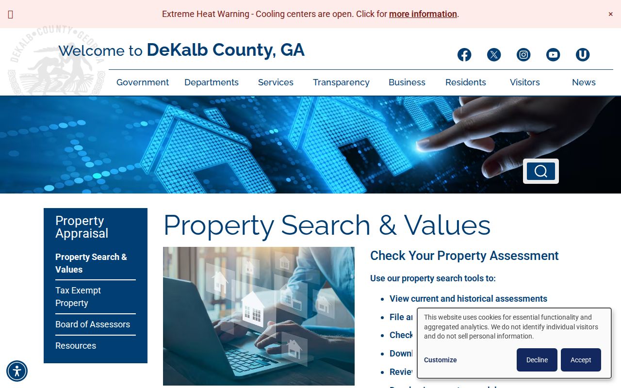
The screen confirms that a researcher can move from address to parcel or owner without treating the roll as a household list.
Map Brookhaven Street Parcels
The DeKalb Property Mapping and Land Records service turns the parcel result into a block view. Zoom until outlines appear, select the target lot, then click parcels beside and behind it. The official parcel schema publishes first and second owner names, site and postal addresses, property description, subdivision or condominium name, class, and last update date. Condo geometry needs care because several unit records may share or repeat a polygon.
GIS can also supply the latest deed or plat book and page from an address or parcel ID by email at mappingteam@dekalbcountyga.gov. It does not issue the deed and cannot settle a boundary dispute. The page illustrates that division of work.
Open the county GIS land-record instructions.
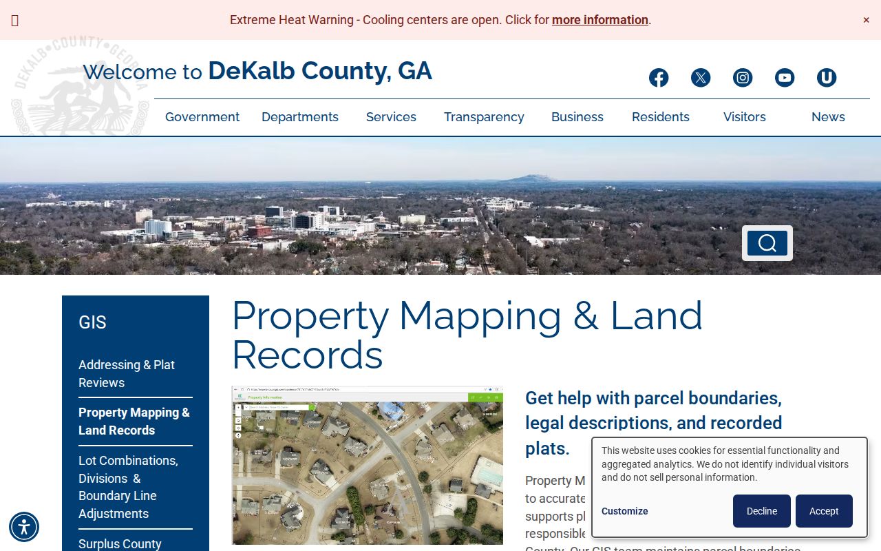
The image supports the map-to-record handoff: use GIS for location and book-page help, then obtain instruments from the clerk.
The official DeKalb tax-parcel layer exposes the same field-level distinction in a public service.
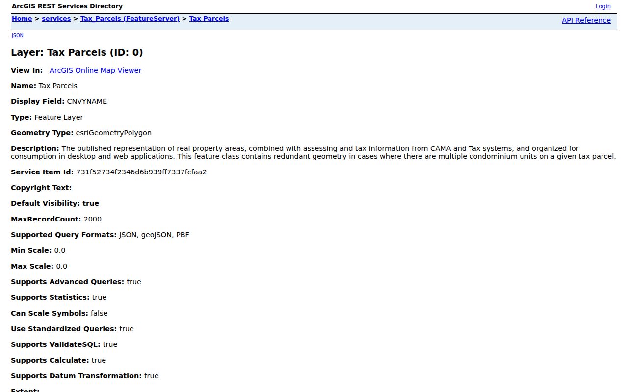
Its separate site and postal fields make absentee ownership visible without claiming that either field lists all residents.
Note: A parcel map is not a survey, and visible lines should not be used to decide an encroachment or legal boundary.
Brookhaven Street Record Coverage
No single Brookhaven street directory answers every address question. Each official set has a narrow role. Use the parcel ID and legal description to keep records tied to land when names or street labels change.
| Address record | Custodian | Street evidence | Access route |
|---|---|---|---|
| Appraisal roll | DeKalb Property Appraisal | Owner, site and postal address, class and characteristics | Free property search |
| Parcel geometry | DeKalb GIS | Lots, adjacent parcels, subdivision and municipal context | Free viewer and parcel service |
| Deeds, plats and liens | Clerk Real Estate Division | Recorded parties, legal land and ownership chain | LandmarkWeb from 1979; office or archive earlier |
| Elector lists | DeKalb Elections | Permitted registration fields with protected data removed | Existing-file request; MVP is not street browse |
| Permits and projects | Brookhaven Community Development | Address, applicant or agent, scope and dates | Project portal or open-records request |
| Reverse directories | DeKalb County Public Library | Historic occupants arranged by address when a volume exists | Decatur Library; dates must be confirmed |
A permit names someone connected with work, not necessarily a resident. A deed names parties to an instrument, not every occupant. A voter record may lag a move. When the same address and person appear in two dated sources, the inference becomes far stronger.
Access continues even when a web tool fails. Property Appraisal and GIS provide online starting points. Real Estate deputy clerks assist at the office on weekdays from 8:30 a.m. to 4:30 p.m., though the office says recorded-document research is not performed by telephone. For older deeds, use the clerk's physical books, Georgia Archives microfilm cards, or genealogical digitizations. For a city permit or project file that is not exposed online, submit a narrow request for an existing record. These routes keep a Brookhaven by-address project moving without assuming every index is complete.
Deeds Along Brookhaven Streets
LandmarkWeb states that its online DeKalb instrument coverage begins in 1979. Search modes include name, document, book and page, parcel ID, record-date range, instrument number, legal terms, and a quick-search selector. A grantor gives or sells an interest. A grantee receives it. Start with the present owner's acquisition deed, note the grantor, then search that person or entity as an earlier grantee.
Match the subdivision, lot, block, parcel history, and legal description at each step. Names alone are unsafe because people and companies can share names. Security deeds show a lending interest and do not by themselves transfer ownership. A plat is the recorded drawing that places lots, roads, and boundaries within a subdivision.
LandmarkWeb's index result can expose party names and roles, document type, recording date, instrument number, and book and page. Parcel or legal data appears when it was indexed, and linked image behavior can vary by browser. The index is a locator. Obtain the recorded document when wording, signatures, or the full legal description matter. DeKalb Real Estate can provide the official copy route, while GIS only points to the latest reference. No official fee was confirmed in the project research, so check the current clerk schedule before ordering.
See the DeKalb deed-index search modes and coverage notice.
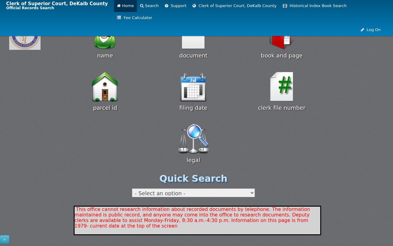
The portal image marks the online starting point, while earlier work moves to physical grantor-grantee books, microfilm, and Georgia Archives county cards.
Brookhaven Street Record Terms
Four terms keep the street-by-street trail precise. They distinguish a place, a tax key, a recorded plan, and a historical occupant tool.
- Parcel
- A mapped unit of land used by the county for appraisal and record links; splits and combinations may change its identifier.
- Site address
- The physical location of the parcel, also called the situs address. It is distinct from the owner's mailing address.
- Plat
- A recorded map showing lots, blocks, roads, and other subdivision details tied to deeds.
- Criss-cross directory
- A directory arranged by street and house number instead of only by surname, useful for finding past occupants.
The modern parcel trail belongs here. Detailed historical volumes and how to read them are covered in the Brookhaven city directory material.
Brookhaven Streets Changed Names
Chandler Road became Dresden Drive, and Old Decatur Road became Clairmont Road in the area studied by the Mann House HABS record. A 1943 directory listed only three residents on the examined Chandler Road stretch. Road maps from 1945 and 1951 help bridge that older rural pattern to postwar streets. Archway and Mannville Drives did not yet exist before World War II.
Search both names in directories, deeds, plats, and newspapers. Legal descriptions often survive a road-name change better than a typed address. Brookhaven Heights and Fernwood supply much of the nearby prewar subdivision context, while later plats and tax cards reflect Georgian Hills and other postwar growth.
Note: A failed modern-name search may mark an older road label or a street built after the period, not a missing household.
Check Brookhaven Street Jurisdiction
A Brookhaven postal address does not establish that a parcel lies within Brookhaven. ZIPs 30319, 30324, 30329, and 30341 cross wider areas. LaVista Park joined the city at the end of 2019, so an earlier permit or service file may remain with DeKalb County even when the same address is municipal today. Check the city-limit layer and the record date before sending a request.
Brookhaven permit, rezoning, variance, and project files may show the address, owner or agent, work description, and dates. When the public project interface does not return the needed existing record, use the Brookhaven open-records channel. Ask by exact address, parcel ID, department, subject, and date span. Georgia agencies need not create a new compilation.
The Brookhaven Street Sign Topper Program also documents how accepted neighborhood names require stable, mapped, nonoverlapping boundaries.
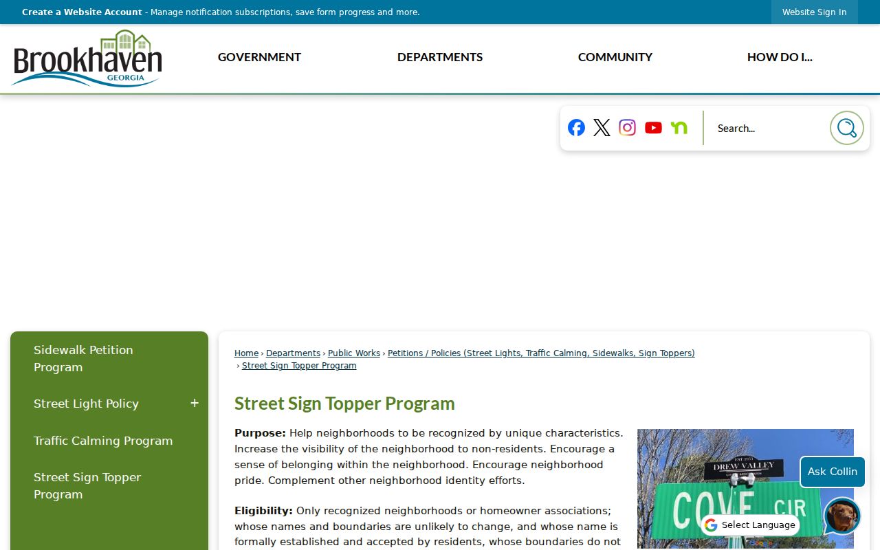
The program image reinforces a core street-search rule: civic neighborhood labels, postal areas, parcels, and city limits are related but not identical.
Limits of Brookhaven Street Records
Public parcel records do not enumerate renters, children, roommates, or guests. Driver-address data is restricted by federal law, and utility or delivery customer lists are not general public directories. VoteSafe can protect an eligible Georgia voter's residence address. Certain officials' home contact details and other protected personal data may also be withheld.
Brookhaven had 24,271 households in the 2020 through 2024 profile, while owner occupancy was 52.6 percent. That gap explains why an owner roll can never serve as a complete Brookhaven street directory. Directories, census schedules available through 1950, obituaries, and lawful elector records can add context, but each source has its own date and limits.
Lawful use. Brookhaven address records are for lawful personal research, family history, property questions, and civic review. Never use them to stalk, harass, threaten, or harm anyone.
When an address trail becomes a search for one person rather than a whole road, the Brookhaven resident lookup workflow keeps names, dates, and roles from being mixed.